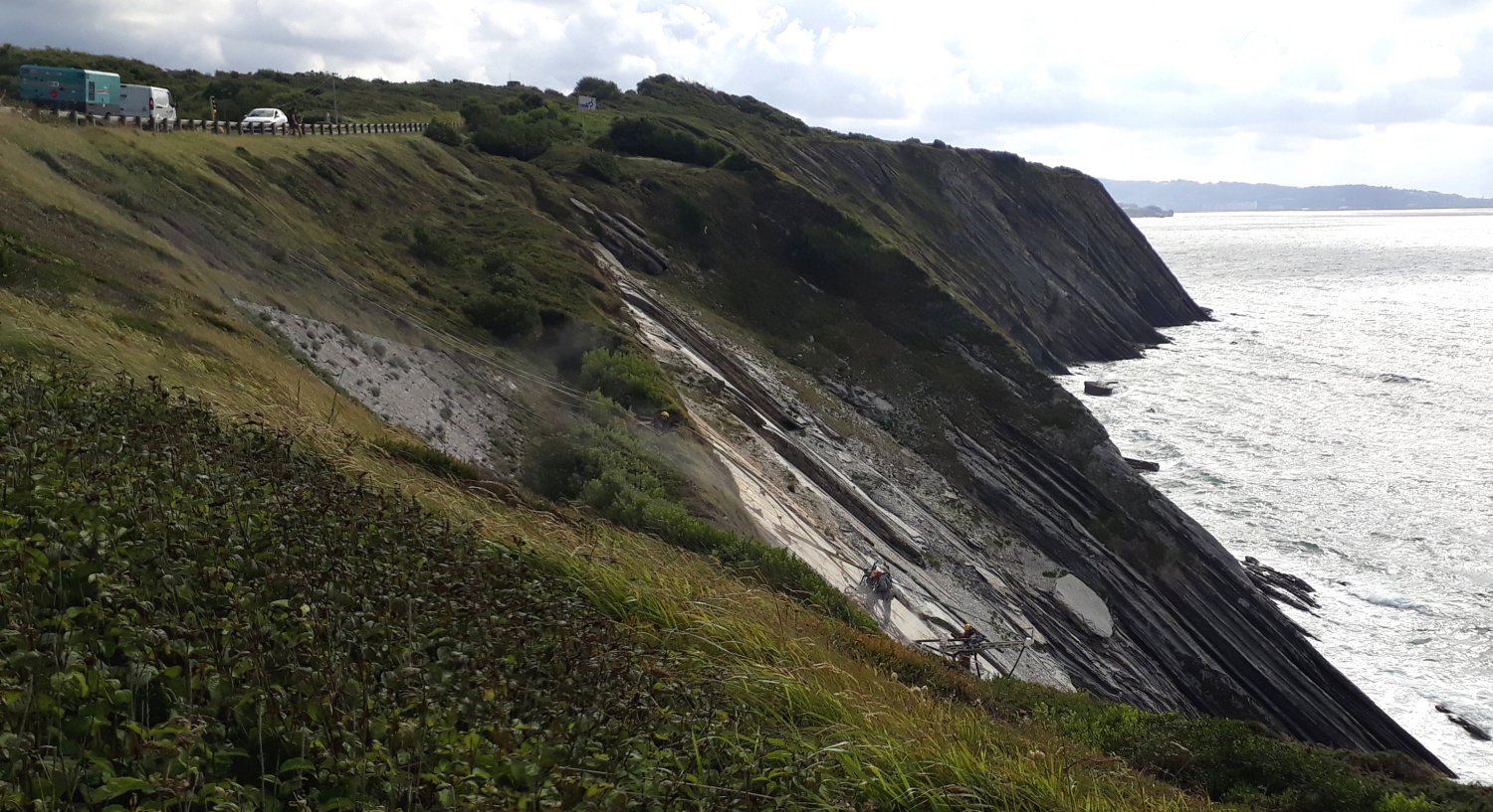
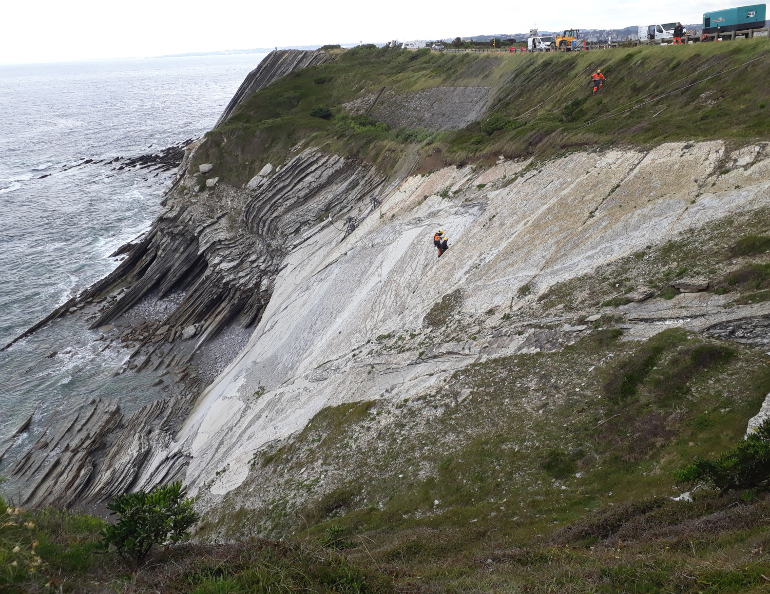
Hendaye, monitoring coastal erosion in high risk areas
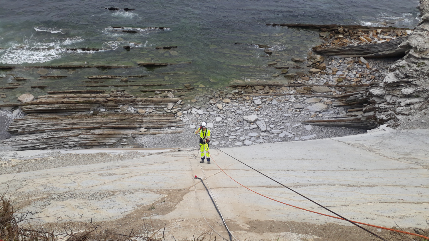
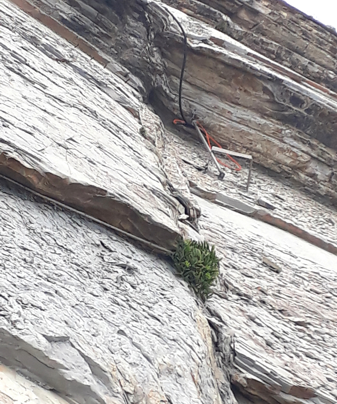
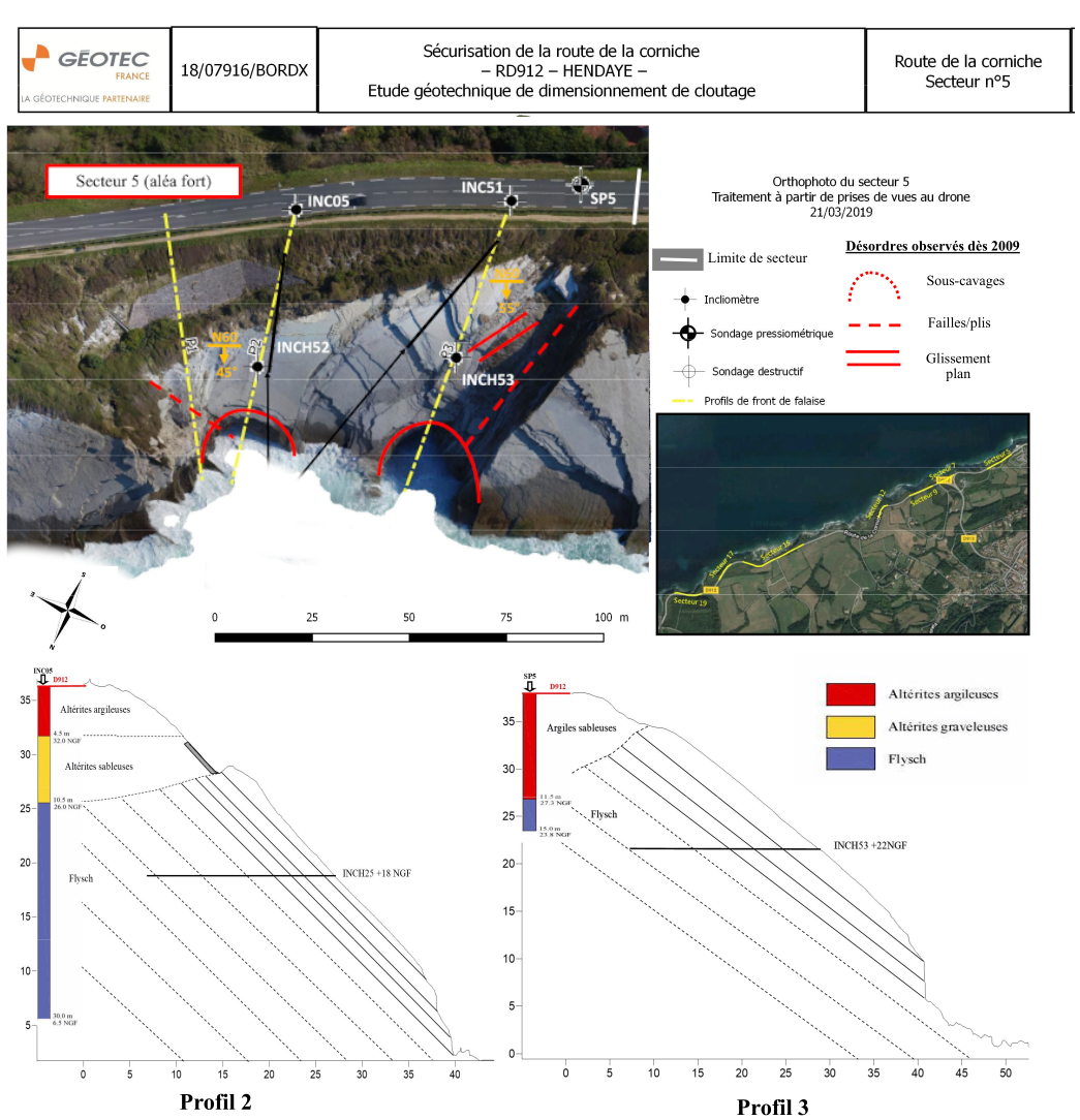
The coastal area is subject to severe erosion and the retreat of the land can be dangerous in some cases. The Corniche road (D912), which connects Hendaye with Saint Jean de Luz, runs along the cliff. This road, which is very popular with tourists, is prone to landslides due to the geology (clay and flysch layers with an inclination parallel to the slope). The activity of the sea causes landslides, which can endanger the users of the road.
Monitoring
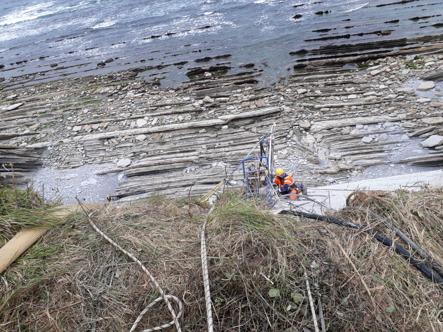
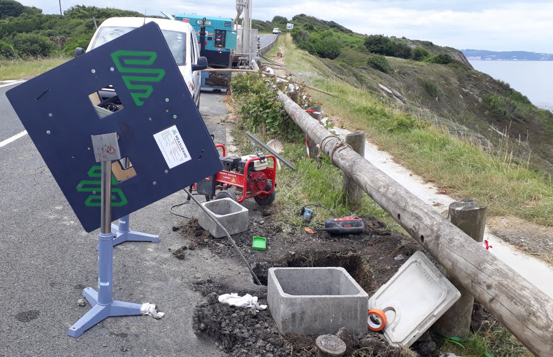
In cooperation with the company Geotec, a three-dimensional monitoring system and alarm system for the critical areas was installed. This provides the departmental authorities with real-time information on the condition of the road and enables them to trigger a road closure.
The instrumentation
The instrumentation consists of :
Two vertical inclinometer chains, depth 28 m and 37 m, measuring points every 50 cm
Two horizontal inclinometer chains, length 20 m, measuring points every 100 cm
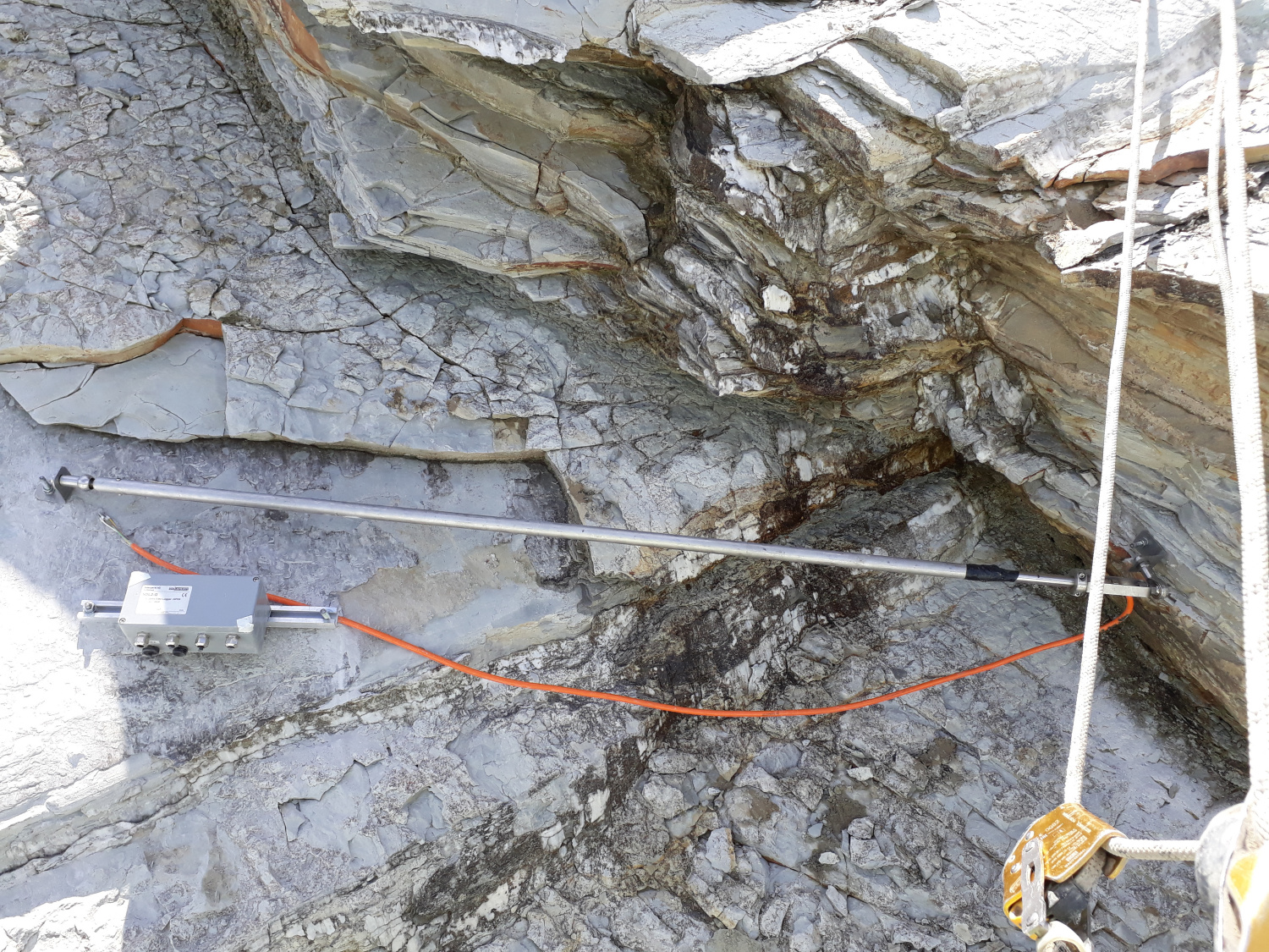
Two borehole extensometers coupled to the horizontal inclinometer chains to measure lateral displacements.
Two surface fissurometers to track the surface movements of the benches
An autonomous data acquisition system with automatic data transmission for visualisation.


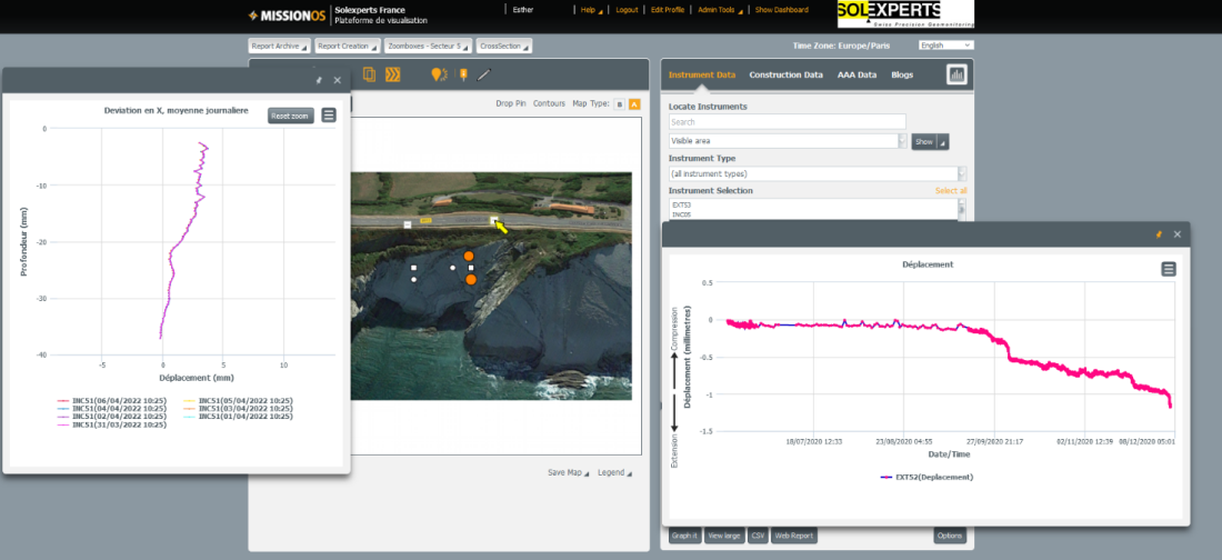
Visualisation, alerting
The hourly recorded data are sent to a web platform. The measurement data show correlations with temperatures and tides. Therefore, meaningful alarm values could be defined only after a year of monitoring and an e-mail and SMS alarm system for the department services could subsequently be set up.
Downloads
Monitoring
Monitoring
- Leica total station with Solexperts GeoMonitor
- Motion-controlled Leica and Zeiss optical digital levels
- Automatische Überwachung des Kalottengewölbes im Aeschertunnel
- Überwachung der BLS-Gleise in Frutigen mit Neigungssensoren
- Automatische Überwachung der Herrenbrücke Lübeck
- Messanlage zur Überwachung von Rutschhängen
- BLS-Tagbautunnel Engstlige Messtechnische Überwachung der Baugrub
- Erweiterung Rathausparking Bern Automatische Gebäude und Baugrundüberwachung
- Geotechnische Messungen und Versuche in Baugruben, A.Thut 1980
- SDL-Solexperts Data Logger
- GeoMonitor
- MRD – Manual Readout Device
- WebDavis
- Surveillance automatique de la voûte de la calotte du tunnel d’Aescher
- Surveillance automatique du pont de Herren à Lübeck.
- Geomechanische Messungen und Überwachung der Stützmauern/Pfahlwände Court und Roches
- Überwachung verankerter Stützbauten: Vorgehen, Interpretation, Massnahmen
- Überwachung verankerter Stützbauten: Vorgehen, Interpretation, Massnahmen
- GEOMECHANISCHE MESSUNGEN UND ÜBERWACHUNG WÄHREND DEM SPRENGVORTRIEB DER TUNNEL VAL D’INVERN, LA ROCHE UND SALGESCH
- Dichte Siedlungsräume und beweissichernder Einbezug der Nachbarliegenschaften in Projektierung und Bau: Massnahmen, Sinn und Zweck
- Geotechnische Überwachung des Tunnelvortriebes Luzernerring, Basel
- Auscultation d’une ancienne mine de fer lors d’une expérimentation d’ennoiement
- Auscultation d’une paroi clouée à Önzberg
- Uetliberg
- AUTOROUTE A16 LA TRANSJURANE
- l’église Saint-Bernard (Lyon)
- INSTRUMENTATION POUR LA SURVEILLANCE DE FALAISES A RISQUE
- Web-based data visualisation for tunnel and deep excavation monitoring
- Challenges to monitoring during construction of two inner city railway infrastructure projects
- Cloud-based 3D digital twin and fiber optic instrumentation of a pre-stressed concrete bridge for the continuous evaluation and monitoring of its structural condition
- Advanced Tailings Storage Facility (TSF) Monitoring Solution: Ensuring Safety and Compliance
- INSITU TESTING AND GEOMONITORING
Solexperts France
- Instrumentation géotechnique dans le Laboratoire Souterrain de Meuse/Haute-Marne
- Alptransit
- Laboratoire de recherche Meuse/Haute Marne Mesures hydromécaniques dans une roche argileuse profonde
- Reconnaissances à l’avancement dans la galerie hydraulique Salazie-Amont
- Modular yielding support for tunnels in heavily swelling rock
- SysMoG Tribune de Genève H2
- High-resolution characterization of the induced fracture network around galleries in the Callovo-Oxfordian Clay using discrete fracture network inversion
Publications Gas Measurements
- 2021 Lacroix, Piedevache, In situ continuous monitoring of dissolved gases
- 2021 Baseline Subsoil CO2 Gas Measurements
- Mont Terri underground research laboratory – CO2 containment assurance experiments
- Lessons Learned from Practical Application of Geochemical Monitoring Methodology to CO2 Storage Site: Specific Case of Claye-Souilly project, Paris Basin, France
- Well integrity assessment under temperature and pressure stresses by a 1:1 scale wellbore experiment
- Mapping of natural CO2 emissions before NECCS
Solexperts France Products
- Temperature measurement chain TMK2
- Chaîne inclinométrique pour mesure de convergence
- Systèmes pour contrôle d’inclinaison CLINO, CLINO RAIL et CLINO
- Chaîne inclinométrique
- Pressure sensor with Data-Logger SDL for piezometer
- Capteur de pression Drive Point pour piézomètre
- Tube inclinométrique Solexperts ICL 63
- Total Pressure Cell
- Extensomètre de surface à fil invar
- Extensomètre à corde vibrante (béton)
- Extensomètre à corde vibrante (acier)
- Cellule de charge à corde vibrante (FCV)
- Cellule de charge DMS
- Cellule de charge